Drone Planning and Approval App for Drone Operators
Drone Assist is a leading flight-planning app that helps operators identify no-fly zones, avoid ground hazards, and ensure compliance. It streamlines the planning process with smart mapping and digital approvals, improving safety and efficiency for professional and recreational pilots alike.
An Ecosystem in Action
Designing Drone Assist wasn’t just an upgrade of an existing app; it was an overhaul from the ground up. The old app was limited in its integrations, whereas the new version touches every part of the Altitude Angel ecosystem.


User Researched Throughout
How do you take an existing app that’s already popular in the market and make it the number one UK drone flight planning app for iOS and Android? Many hours of user interviews, iterations, quantitative and qualitative research, and extensive Alpha and Beta testing contributed to the final result.
A Short Roadmap to Success - a Summary
Existing user research – Users were asked to accomplish various tasks in the existing application. Contextual enquiry and user observation were used to identify pain points, frustrations, and features that required development. The study also included usability testing to validate ease of use and task completion
Competitor and market research – Since the launch of the original Guardian app, competitors had entered the drone flight planning market. These were analysed in terms of features and scope, and compared against the Guardian app.
Journey mapping – Existing user journeys were mapped in FigJam. Using data gathered from the first round of testing, new workflows were developed and validated with the original test group using the same research methods.
Iteration and prototyping – Based on the first two studies, functional Figma prototypes were developed from the base flows for the first release. These were tested both with the original user base and a wider audience, including non-users.
Accessibility audit: Ensuring compliance with WCAG guidelines, especially for mobile use in the field.
Development and Alpha testing – Following user feedback and prototype iterations, an alpha version was built by the iOS and Android development teams. Internal testing, QA, and qualitative user testing were conducted to refine the product.
Beta testing – A semi-final beta version was released to 500 users. Surveys were used to test journeys, satisfaction scores, and newly added features.
Version one release – Version one was released to the market with great success. The user base increased fivefold, and App Store ratings rose from 2.5 stars to 4.7 stars within six weeks.
Post-release monitoring – Adoption metrics and analysis using Google Analytics and Firebase were used to monitor the app and address feedback or technical issues promptly.
Continuous iteration: Post-release, analytics and feedback are used to prioritise improvements in subsequent updates.
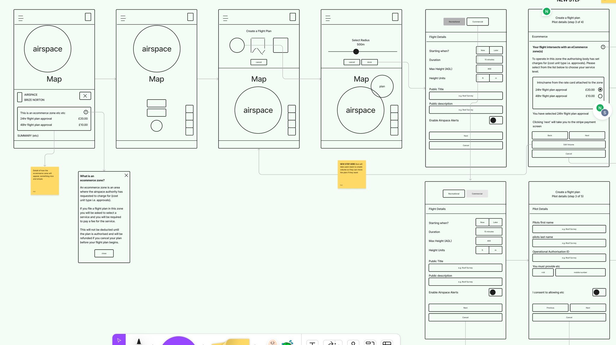
A consistent mobile journey
Flight planning is a complex process: weather, altitude, and airspace restrictions all come into play before a user can start a flight, as well as permissions gained through airspace authorities both within the Altitude Angel software ecosystem and via external channels.

Planning on the move
Due to the nature of the product, users have the option of light and dark modes. This goes beyond aesthetic preference; the app is used in the field in all weather conditions, so extensive testing ensured maximum clarity, especially in bright sunlight.
